National Weather Service Issues High Surf, Rip Current, Wind & Snow Advisories
![]() Edhat Staff
January 9, 2024, 7:39 am
1.6k Views
Edhat Staff
January 9, 2024, 7:39 am
1.6k Views

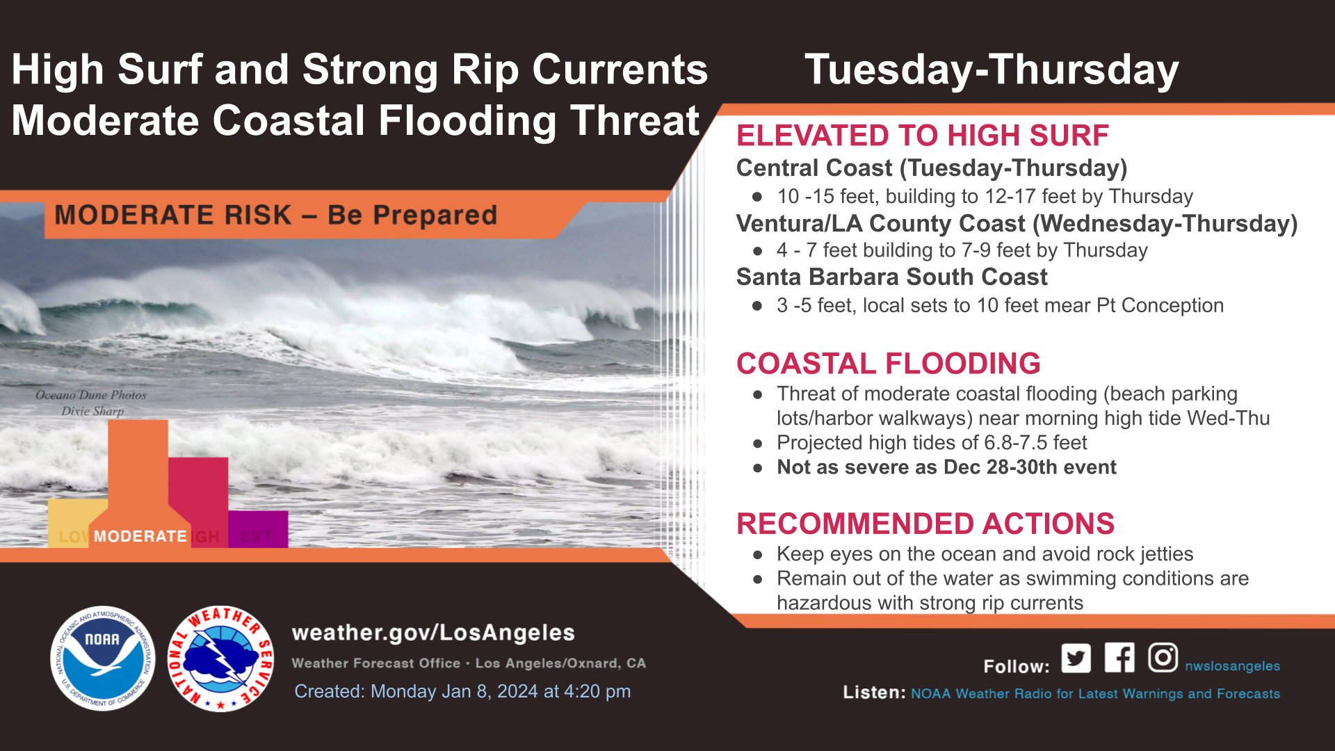
The National Weather Service (NWS) has issued a slew of alerts for Santa Barbara County this week.
A High Surf Advisory is in effect from 9:00 p.m. Tuesday to 9:00 a.m. Friday. Large breaking waves of 10 to15 feet are expected on Wednesday and 12 to 17 feet on Thursday with dangerous rip
currents.
A Coastal Flood Advisory is also in effect from 3:00 a.m. Wednesday to 12:00 p.m. Thursday. Minor coastal flooding is expected at the time of the morning high tides.
Beaches throughout the Central Coast are expected to be impacted this week.
Flooding of sea water is likely, around the time of high tide, over vulnerable low-lying coastal areas such as parking lots, beaches, and walkways. Although the NWS states significant damage to roads or structures is not expected.
“There is an increased risk for ocean drowning. Rip currents can pull swimmers and surfers out to sea. Large breaking waves can cause injury, wash people off beaches and rocks, and capsize small boats near shore,” NWS states. “Take the necessary actions to protect flood-prone property. Do
NOT drive around barricades or through water of unknown depth.”
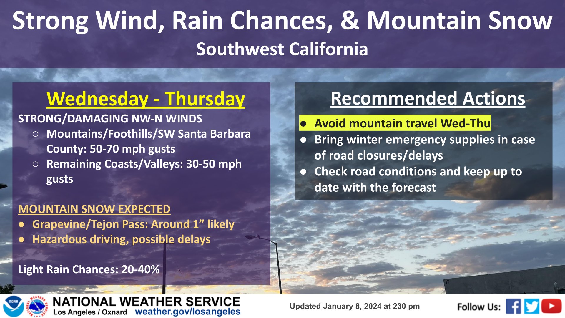
A wind advisory remains in effect from 10:00 a.m. Tuesday to 4:00 p.m. Wednesday while a High Wind Watch is in effect from Wednesday afternoon through Thursday afternoon.
For the Wind Advisory, north winds 20 to 30 mph with gusts up to 55 mph expected. For the High Wind Watch, northwest winds 25 to 35 mph with gusts up to 60 to 70 mph possible.
Damaging winds could blow down large objects such as trees and power lines. Power outages are possible. Travel could be difficult, especially for high profile vehicles.
Additionally, light to moderate snow showers have the potential to impact the Interstate-5 corridor and the northern Ventura County mountains Wednesday night into Thursday, NWS states.
“While accumulating snows are uncertain, there is a 40 percent chance of 1-2 inches of snow and a 10 percent chance of 2-4 inches of snow. The snow could combine with the strong winds to create significant visibility restrictions, along with hazardous travel. This includes the Interstate-5 Grapevine,” reports the NWS.
Drivers are advised to monitor the latest forecasts and warnings for updates on this situation. Fasten loose objects or shelter objects in a safe location prior to the onset of winds.
Written by Edhat Staff